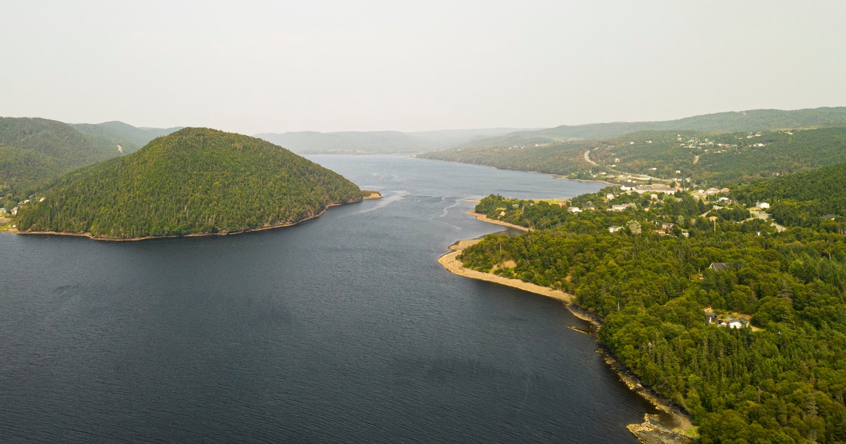
The Miawpukek First Nation is situated at the end of the beautiful Baie d’Espoir fjord at Conne River on the south coast of Newfoundland—where green forested hills meet the sea. During warmer months, the morning air is full of songs from Black-capped Chickadees, Swainson’s Thrush, White-throated Sparrows, Ruby-crowned Kinglets, Yellow-bellied Flycatchers, and Black-and-white Warblers. The afternoons are alive with the sound of gulls and kittiwakes. Greater Yellowlegs dot the shoreline during low tide. Bald Eagles can be found on twisted branches at the edge of the forest or soaring overhead. In other words, this place is teeming with birds as well as other wildlife.
The people here are working on two initiatives to protect these vibrant lands and waters—the self-declared Little River Indigenous Protected and Conserved Area (IPCA) and the South Coast Fjords National Marine Conserved Area (NMCA). Establishing these protections will help to ensure these vital ecosystems remain healthy for generations to come.
In 2024, the Miawpukek First Nation announced the establishment of the Little River IPCA as a way to preserve the cultural and historical significance of the region for traditional harvesting as well as to conserve the ecological values of the river and surrounding lands. IPCAs are a conservation tool that protect nature and cultural values, while elevating the rights and responsibilities of Indigenous communities. They can be self-declared by the First Nation or co-established with the provincial or territorial government. The Little River IPCA is a self-declared Indigenous Protected and Conserved Area.
In 2023, Miawpukek First Nation and Qalipu First Nation signed a memorandum of understanding (MOU) with the provincial and federal governments to lead a feasibility study on creating a new National Marine Conservation Area to protect the South Coast Fjords. The initiative is currently in the feasibility assessment phase of the multi-step process and has already faced some significant challenges. The original proposed size of the conserved area when the agreement (MOU) was first signed was 9,000 square kilometers. However, in February of 2025 the federal government reduced the size to 6,538 square kilometers, changing the boundaries to address concerns from the fisheries industry.
The process of establishing an NMCA can be a long and arduous journey, but history shows that the Mi’kmaq people are used to overcoming hardships when it comes to what is best for their community. There is a great documentary entitled Forgotten Warriors that tells the story of how in 1983 nine Mi’kmaq activists fought for their community and found justice for their families. The result of these men’s heroic actions set the community on a path from being an impoverished and isolated community with almost 90% unemployment in the 1980s to becoming the strong and vibrant community with nearly 100 percent employment that it is today.
Engaging the youth of the community is a key priority and also an essential part of long-term planning for both the NMCA and IPCA. Passing on traditional knowledge and developing western science, forestry, and maritime skills at an early age helps to pique interest in future job opportunities associated with the protected areas, keeping the management of lands and waters within the community for years to come.
One educational program involves sea expeditions aboard the Polar Prince, a retired Coast Guard icebreaking vessel owned by the Miawpukek First Nation. Aboard, youth and young adults learn all aspects of working on a ship, as well as about marine biology, sea tourism, photography, and ornithology from Universities and NGOs, including Audubon.
For the Miawpukek First Nation, community engagement is not limited to their youth. Adults in the community who have spent time out on the land are being asked to support the Little River IPCA by sharing their knowledge through interviews. Participants are asked to identify the biologically rich locations where they hunt and fish, as well as report any changes they’ve observed on the land over the years. This knowledge is being used to update maps that were created from interviews back in 2006–2007. The maps are then able to inform land management decisions and support their conservation initiatives for years to come.

