


The European Centre for Medium-Range Weather Forecasts sees a major storm developing off the north Tamil Nadu-south Andhra Pradesh coasts over next 3-4 days that India Meteorological Department tends to agree with.
Tamil Nadu and Andhra Pradesh coasts will need to be wary of back-to-back remants from depressions/storms originating in the South China Sea/west Pacific and hatching again as fresh storms over the Bay of Bengal.
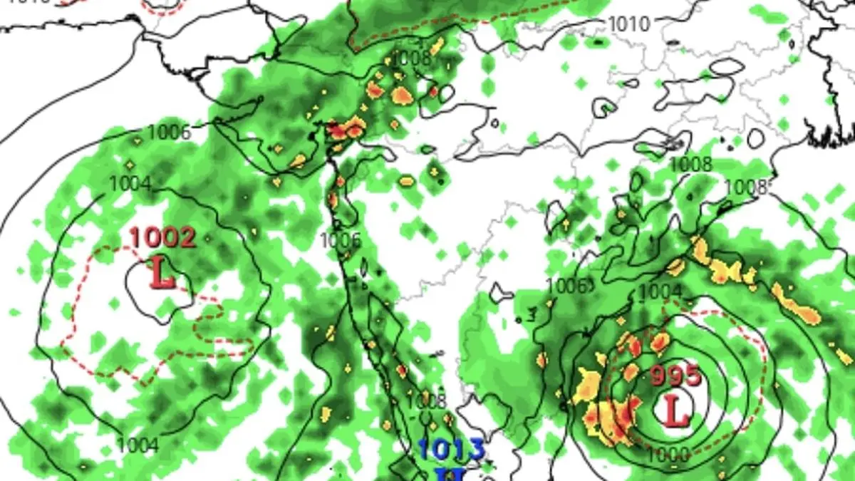
Of these, inbound typhoon Fengshen has already crossed the Vietnamese coast yesteday (Wednesday) and has weakened into a depression. It is likely setting up the next low-pressure area/depression over the Bay of Bengal.
Numerical model predictions from India Meteorological Department (IMD) indicate a rare scenario wherein two preparatory circulations are rearing within an elongated trough that sits diagonally across the Bay from south-east to north-west (Andaman Sea to Tamil Nadu-Andhra Pradesh coasts).
These could spin away as individual storms towards the Tamil Nadu and north Andhra Pradesh coasts, if IMD projections are anything to go by. The twin storms are powered also by an incoming remnant from a depression in the Taiwanese Sea (part of north-west Pacific), trailing Fengshen.
European Centre for Medium-Range Weather however sees only one single consolidated storm showing up just off the north Tamil Nadu and adjoining south Andhra Pradesh coasts by Monday next (October 27). Simultaneously, existing depression over Arabian Sea could likely further strenghening some distance away from the Gujarat and Mumbai coasts.
Published on October 23, 2025


